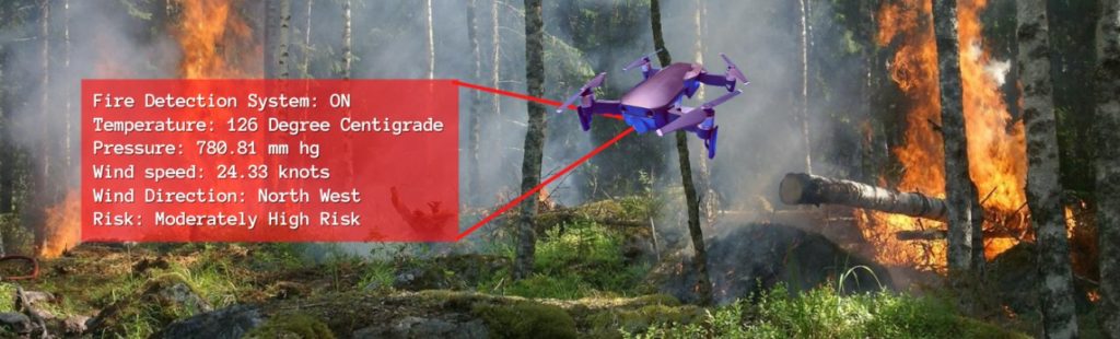
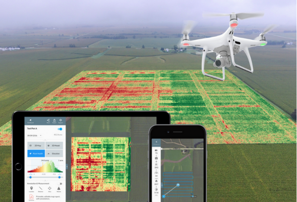
Actionable values hidden inside the Drone Data – Mapping
Mapping refers to the practice of interpreting topographical and orthomosaic images. Drone mapping is a powerful tool to generate 2D maps and 3D models to be used in areas of survey, construction, and engineering. Assume, that you are planning to do a construction project on a 500-acre land. You will need a detailed analysis of […]
Actionable values hidden inside the Drone Data – Mapping Read More »